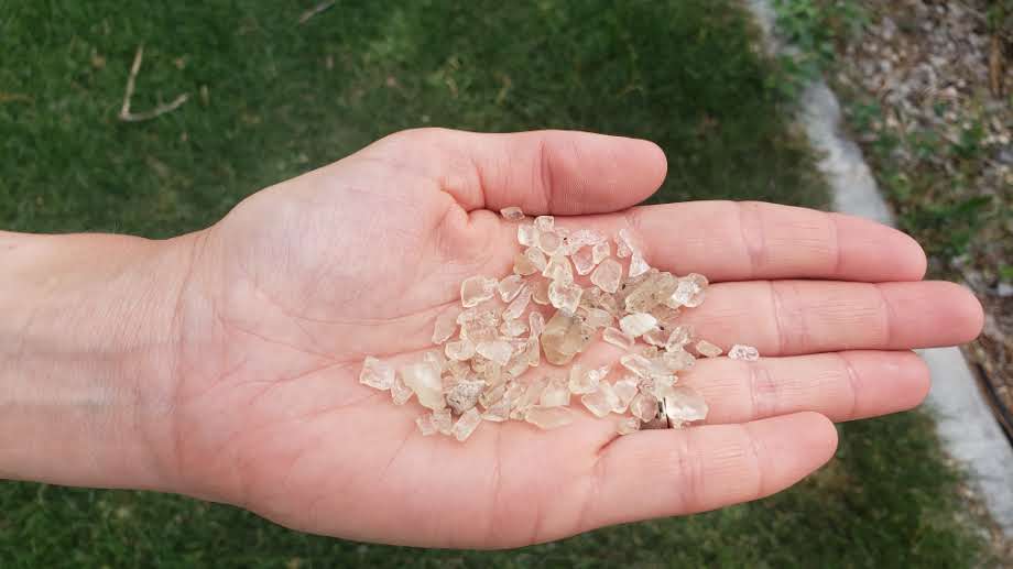
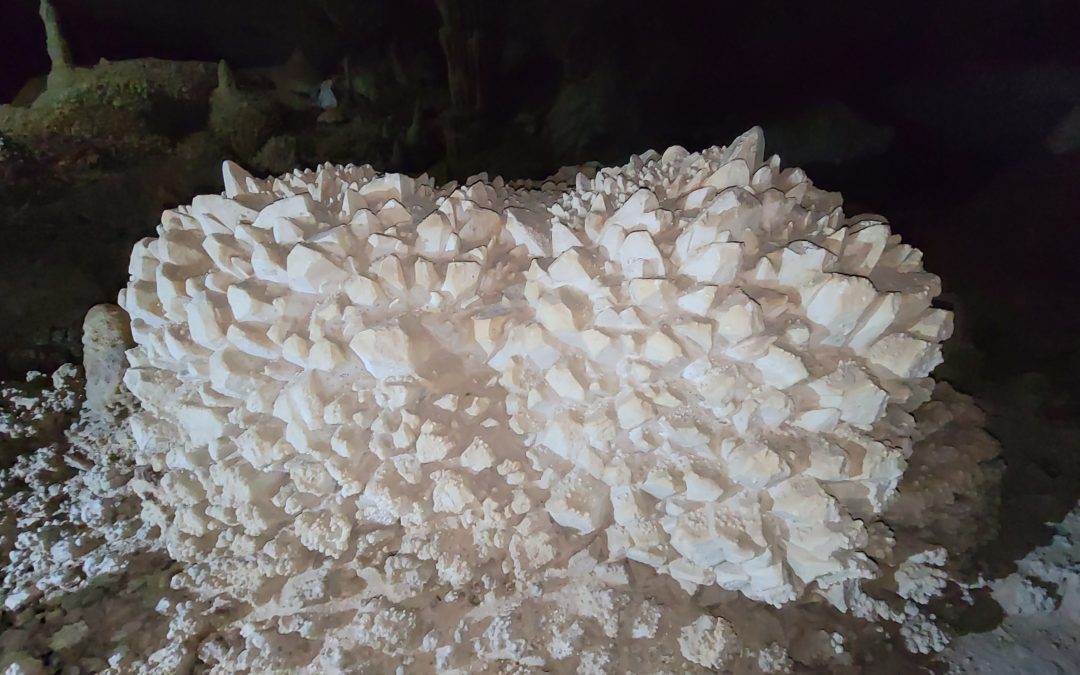
Discover a hidden gem in the middle of Utah’s West Desert at Crystal Ball Cave. This off-the-beaten path cave displays stalagmites, stalactites and large, round calcite deposits that look like a ball of crystals....
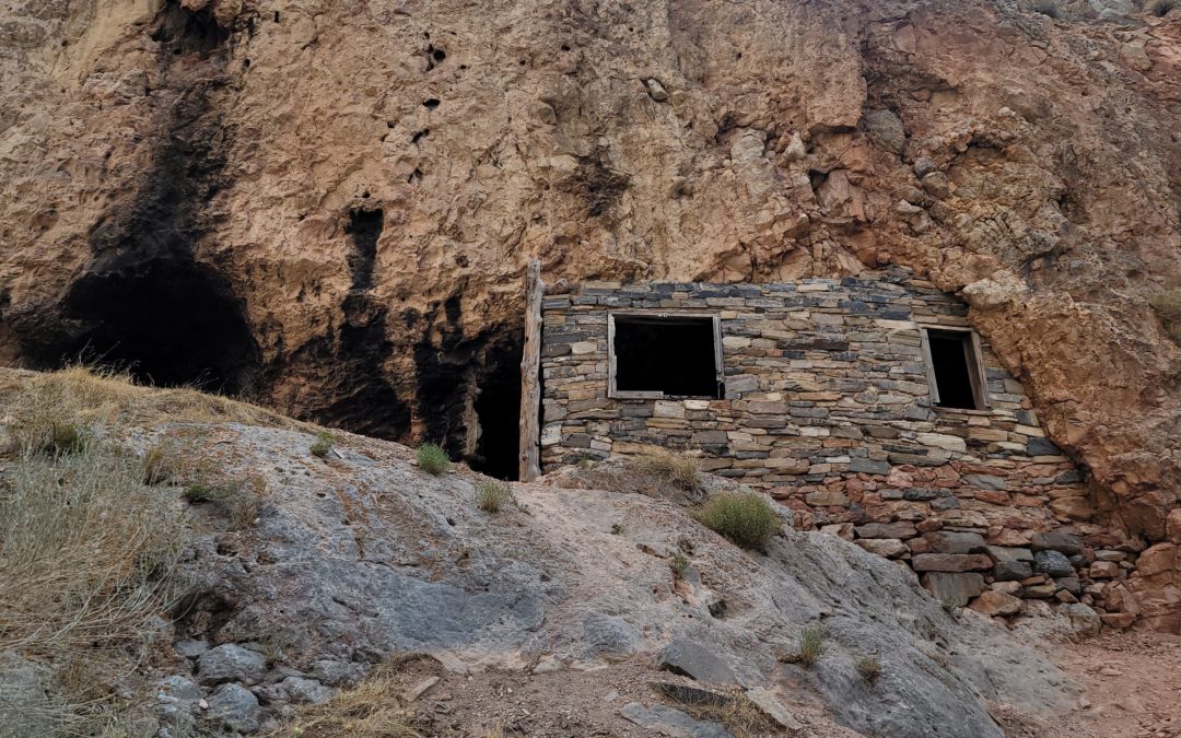
Hermit’s Cabin: Delta, Utah
Hermit’s Cabin: Delta, Utah
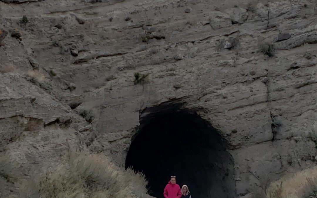
Hermit’s Cabin outside Delta, Utah is a fun, free adventure for all ages. It sparks the imagination of living a secluded life in the Utah’s desert. Explore the the cabin and the surrounding desert canyon.
KID RATINGS
Fun: ⭐⭐⭐ (out of 5)
Difficulty: Very Easy EASY Moderate Hard Very Hard
KEY FEATURES
Distance: 0.5 miles
Elevation Gain: Around 100 ft
Terrain: Dirt, rocks, dirt road
Time Needed: 30 minutes to 1 hour
When to Go: Anytime of the year when there isn’t snow
COST
Free
AMENITIES
-
Closest amenities in Delta, Utah – 1 hour to the east. Make sure to have enough water and gas.
- Dispersed camping on BLM land.
THINGS TO BRING
-
Good walking shoes
-
Full tank of gas
-
Water
-
Snacks/Lunch
-
Vehicle that can drive well on dirt roads, 4WD not required
DETAILS
Our kids loved exploring Hermit’s Cabin and enjoyed making up stories about who lived in the cabin and why. We were lucky to have friends with us that knew some of the background and I was able to look up more when we got home.

Hermit’s Cabin or Hermit’s Cave was built in 1929 by Bob Stinson. Bob returned home from World War I to find that his girlfriend had married someone else. He was traveling through Marjum pass near Delta Utah when his vehicle broke down. He decided to stay where he was and build a stone cabin enclosing a nearby small cave. He ended up becoming employed by the government to maintain the dirt road in the area and lived there until he was 70 years old.

Hermit’s Cabin is remote. It requires an hour drive from Delta, Utah on a dirt road. Follow my map below. There is a small easy walk from the end of the dirt road to the Cabin. Just follow the trail up the canyon from the end of the dirt road, the cabin will be to your left less than a quarter mile away.

Hermit’s Cabin isn’t worth the visit out the desert on its own. But coupled with other adventures it is worth a small detour. We visited Hermits Cabin on our way to Crystal Ball Cave and Gandy Warm Springs.

PROS & CONS
PROS
-
Not crowded
-
Fun for all ages
-
Great place for kids to use imagination
-
Free
CONS
- Remote
- Hot in summer
- No nearby amenities
DIRECTIONS
Hermit’s Cabin is 1 hour west of Delta Utah on backroads that are mostly dirt. It is located off Old Highway 6 and 50 in Marjum Canyon. There is a smaller dirt road in the canyon that you will turn north on. Follow this road till you are unable to drive any further and park your vehicle. You will then continue by foot on the trail up the canyon about 0.25 miles. Hermits Cabin will be on your left. Follow my map below.
MAPS
OTHER NEARBY ADVENTURES
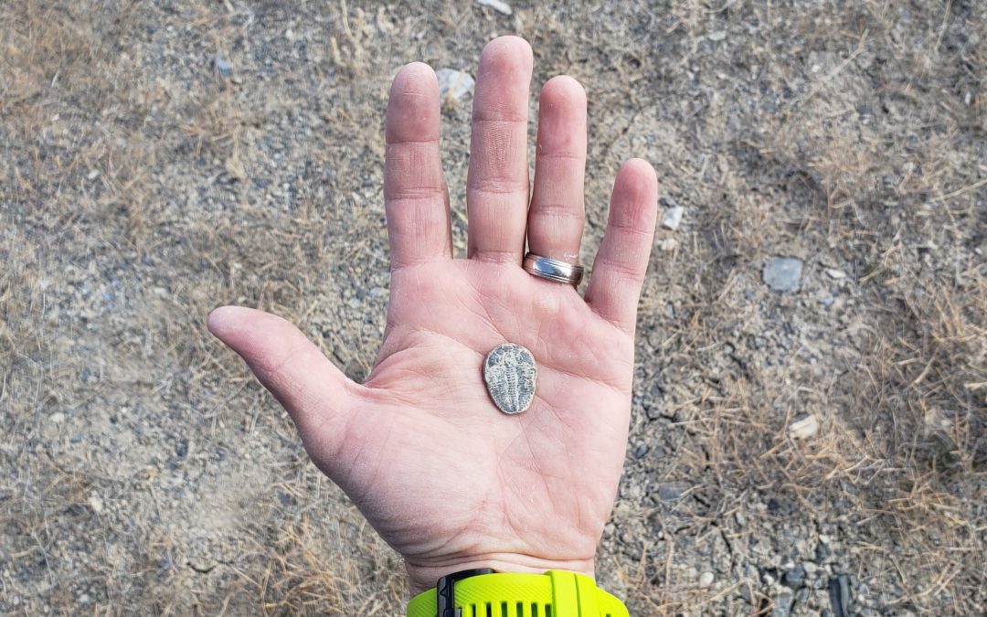
U-dig Fossil Quarry (30 min)
Sunstone Knoll (1 hour 15 min)
Crystal Ball Cave (1 hour 30 min)
Great Basin National Park (1 hour 30 min)
Baker Hot Springs (1 hour 30 min)
Gandy Warm Springs (1 hour 45 min)
Paul Bunyan’s Woodpile (1 hour 50 min)
Devils Gate Slot Canyon (2 hours)

ABOUT
Hi, I’m Corrine! I’m an outdoor enthusiast and mother of four.
My goal is to inspire you to get outside and create your own amazing memories as a family. Life is precious and there are too many adventures to be had to spend life on the couch or in front of a screen.
YOU MIGHT ALSO LIKE:
Crystal Ball Cave: Gandy, Utah
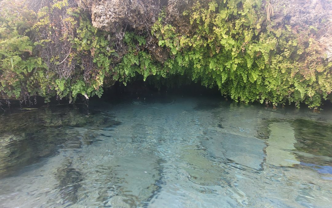
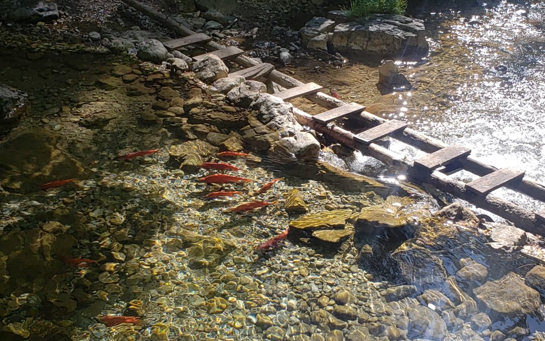
Gandy Warm Springs: Utah’s Desert Oasis
Gandy Warm Springs is an oasis in Utah’s West Desert. Its crystal clear waters offer a way to cool off in the summer heat or warm up on a cold day. You can explore a serene underwater cave that feels more like you...
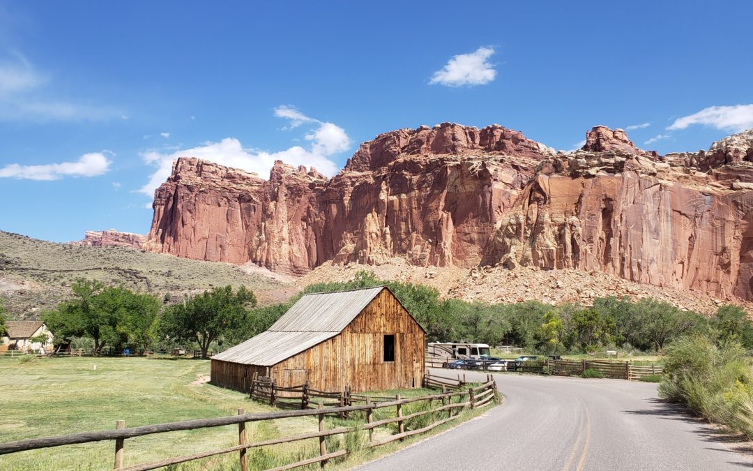
Capitol Reef National Park with Kids
Explore Capitol Reef National Park with kids and discover an oasis in the middle of red-rock and desert in central Utah. Your kids will love picking fruit, hiking to arches and through canyons, playing in streams,...
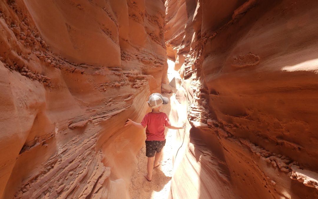
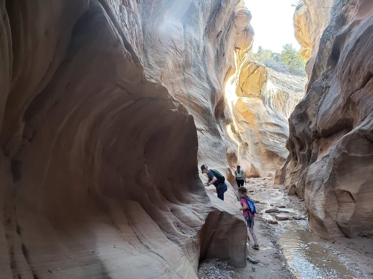
Peak a boo and Spooky Slot Canyons with Kids
Peek-A-Boo and Spooky Slot Canyons in Grand Staircase Escalante Monument, Utah are an out-of-this-world adventure that your kids will always remember. You will feel like you are on a different planet as you traverse...
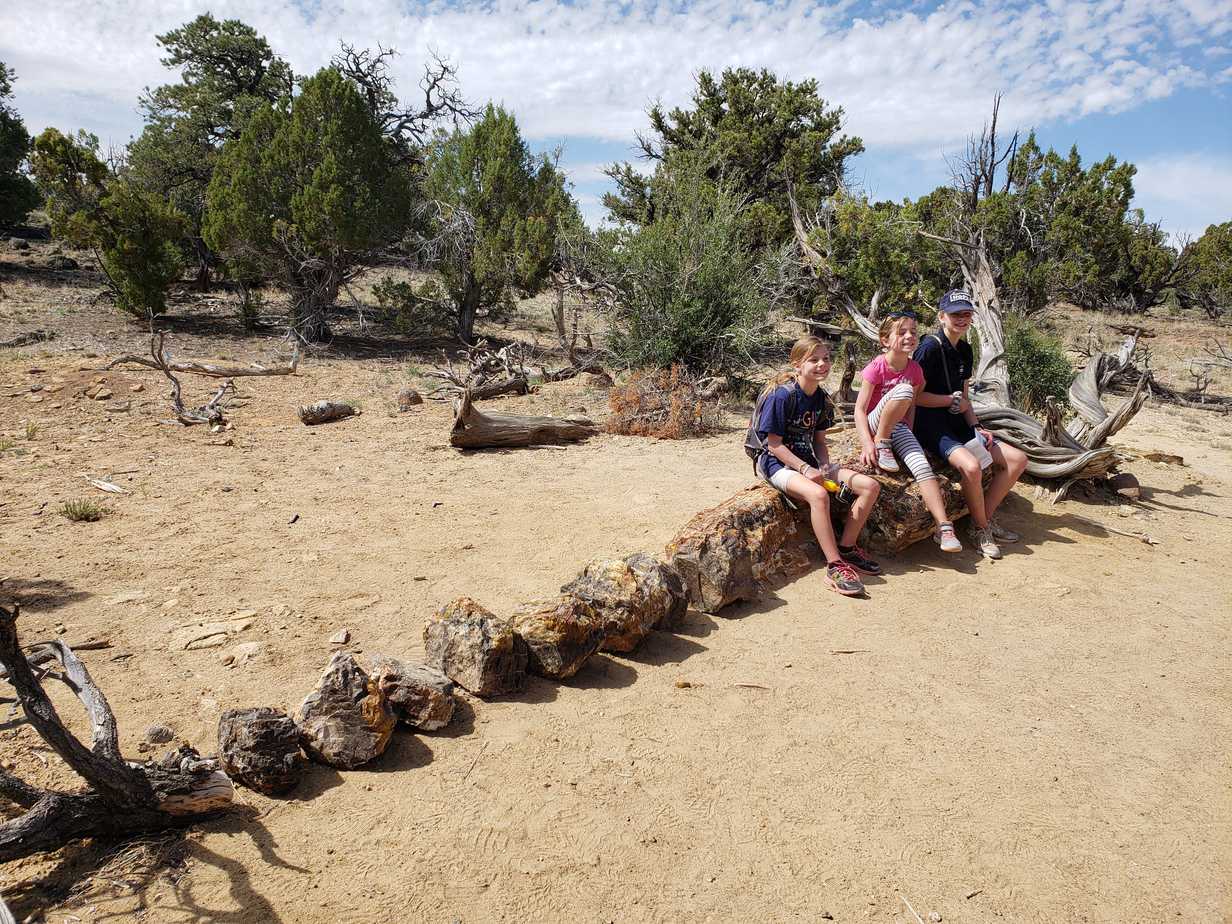
Petrified Forest State Park with Kids: Escalante, Utah
Escalante Petrified Forest State Park with Kids is a must-see stop when exploring Grand Staircase Escalante Monument in Utah with your family. Walk through geological history as you explore colorful, 150 million...